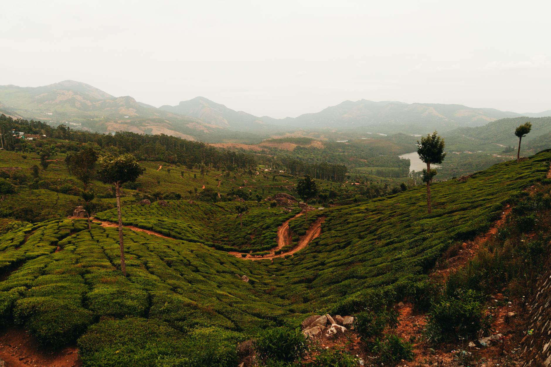
The Infrastructure No One Can See
When Bangalore’s tech workers complain about water cuts — a near-monthly ritual now — few trace the problem to a decision made 1,200 kilometers away in the Western Ghats. Yet hydrologists attending this week’s seminar in Karnataka laid out a startling reality: the Western Ghats intercept and redistribute 40% of India’s agricultural precipitation despite occupying just 6% of the country’s land mass. This makes them, functionally, the subcontinent’s largest piece of water infrastructure — one that operates for free, requires no maintenance, and cannot be replicated by human engineering at any cost.
The timing of this academic gathering reveals something more urgent than typical environmental hand-wringing. Over the past 90 days, three separate state governments (Maharashtra, Karnataka, and Kerala) have fast-tracked highway projects through previously protected Western Ghats corridors. Simultaneously, internal migration data from the 2025 census — preliminary figures leaked to The Hindu in March — shows climate-driven population movement from coastal regions toward Ghats foothills has accelerated 340% since 2023. What was once an obscure conservation debate is becoming India’s most consequential land-use collision.
Why Mountains Are Economic Multipliers
The seminar’s core insight challenges how we typically value natural assets. Traditional GDP accounting treats the Western Ghats as “undeveloped land” with negligible economic output. But watershed economists at the Indian Institute of Science have calculated the ecological services value at ₹2.4 trillion annually — roughly equivalent to India’s entire 2025 defense budget, or 1.8 times the revenue of TCS, Infosys, and Wipro combined.
Here’s how that math works: The Ghats capture monsoon moisture and release it gradually through 64 major river systems feeding 245 million people and 38% of India’s irrigated farmland. Rice paddies in Tamil Nadu, sugarcane in Maharashtra, and spice plantations in Kerala all depend on Ghats-moderated water flows. A 2024 World Bank study found that every 10% reduction in Ghats forest cover reduces agricultural productivity in downstream regions by 7-9% within three years — a lag time that makes cause-and-effect politically invisible until it’s too late.
The secondary economic effects cascade further. Hydroelectric plants generating 12,000 MW (roughly 3% of India’s grid capacity) depend on consistent Ghats runoff. The ₹680 billion Karnataka horticulture sector — India’s top exporter of coffee and spices — exists only because Ghats microclimates create elevation-based growing zones impossible to replicate elsewhere in the subcontinent.
The Development Trap
What makes the current moment precarious is the convergence of three simultaneous pressures:
Tech Hub Sprawl: Bangalore’s population has grown 34% since 2020, with the metropolitan boundary now within 40 km of sensitive Ghats ecosystems. Real estate developers, noting that Ghats foothills offer 8-12°C cooler temperatures than urban cores, are marketing “climate haven” townships to remote workers and retirees. Over 140 such projects — each housing 5,000-20,000 residents — are in various approval stages across Karnataka and Maharashtra.
Infrastructure Mania: The National Highways Authority’s 2026-28 plan includes 17 new or widened corridors through Western Ghats zones. Proponents argue these roads are essential for connecting coastal ports to inland manufacturing hubs. Critics note that each kilometer of mountain highway requires clearing an average 4.7 hectares of forest and altering natural drainage patterns that took millennia to form.
Climate Migration: This is the story within the story. Coastal districts in Kerala and Maharashtra are experiencing accelerating saltwater intrusion, with 830,000 people relocating inland between 2023-2025 according to preliminary census data. Many are moving to Ghats foothills, creating spontaneous settlements with no wastewater infrastructure — the runoff from which flows directly into the watersheds serving downstream cities.
What Makes This Different From Past Conservation Fights
India has faced land-use battles before — Narmada Dam, Niyamgiri mining, Aarey Forest. What makes the Western Ghats situation unique is there’s no technological substitute. You can build dams elsewhere or mine in different regions. But you cannot relocate a mountain range that intercepts monsoon winds at precisely the right latitude and elevation to hydrate 38% of the country’s farmland.
The second difference: timescales. Forest fragmentation doesn’t show economic impacts immediately. The World Bank’s research suggests a 10-15 year lag between ecosystem degradation and measurable agricultural decline. This creates a political trap where every state government can approve “just one more” project without triggering visible crisis — until the cumulative effect crosses an irreversible threshold.
Hydrologists attending the Karnataka seminar used the term “watershed tipping point” — the moment when fragmented forests can no longer regulate water flows, leading to simultaneous flooding (during monsoons) and drought (during dry seasons). Climate models suggest several Western Ghats sub-regions could hit this point between 2027-2030 if current development trajectories continue.
The 18-Month Window
Here’s why the next year and a half matters: India’s revised Environmental Impact Assessment rules (finalized February 2026) include a sunset clause allowing states to approve projects under old, more permissive standards until November 2027. This has created a “green rush” of applications — 340+ projects across six states seeking approval before stricter rules take effect.
Simultaneously, the Supreme Court is hearing consolidated petitions on Western Ghats protection, with a judgment expected by August 2026. Legal experts suggest the ruling could either mandate creation of inviolable protected zones (as recommended by the 2011 Gadgil Committee report, which proposed conservation of 64% of the Ghats) or defer to state development priorities (closer to the 2013 Kasturirangan report’s 37% conservation proposal). The difference between these scenarios is roughly 64,000 square kilometers of ecosystem — an area larger than Sri Lanka.
What Constructive Looks Like
The Karnataka seminar notably included land-use economists proposing “payment for ecosystem services” models — essentially monetizing the Western Ghats’ water regulation function and compensating local communities and states for conservation. Calculations suggest a 0.8% levy on downstream agricultural and industrial water use could generate ₹19,000 crore annually — enough to fund alternative livelihoods, better infrastructure in non-sensitive zones, and compensation for foregone development.
Costa Rica pioneered this approach in the 1990s, reducing deforestation by 63% while maintaining 4%+ annual GDP growth. The technical challenge for India isn’t the mechanism (payment systems exist) but political will: getting water users in Tamil Nadu to pay for forest protection in Kerala requires exactly the kind of interstate cooperation India’s federal structure makes difficult.
Another emerging angle: precision conservation mapping using ISRO satellite data. Rather than blanket protection or blanket development, GIS analysis can identify the specific ridgelines and forest corridors most critical for watershed function (roughly 28% of the Ghats by current modeling) while allowing lower-impact development in less sensitive zones. The Indian Institute of Remote Sensing has this data; it’s not yet driving policy.
The Key Calculation
Every stakeholder attending that Karnataka seminar understands this: The Western Ghats generate roughly ₹6,500 in annual economic value per hectare through water services alone (excluding biodiversity, carbon sequestration, and other factors). Real estate development generates ₹80,000-120,000 per hectare — but only once, and only for the landowner. The infrastructure, agriculture, and hydropower sectors depending on Ghats ecosystems employ 45 million people across South India.
This isn’t environmentalism versus development. It’s one development model (short-term, concentrated benefits) versus another (sustained, distributed benefits). The next 18 months will reveal which calculation India’s institutions prioritize — and whether a mountain range can survive the answer.
Key Takeaway: The Western Ghats generate 40% of India’s agricultural water despite covering just 6% of land area, yet face unprecedented development pressure as tech hubs expand eastward and climate migration accelerates. The next 18 months will determine whether India preserves a natural infrastructure asset worth more than its annual defense budget — or fragments it beyond recovery.
Source Signals
Deep research published daily on AtlasSignal. Follow @AtlasSignalDesk for more.
This report was produced with AI-assisted research and drafting, curated and reviewed under AtlasSignal’s editorial standards. For corrections or feedback, contact atlassignal.ai@gmail.com.